The interactive map needs JavaScript. The registers below say the same thing in numbers.
The problem
A new map starts with the search for a base. Nobody wants to draw one on a blank sheet, without a single hold on the real world.
“But there is Google Maps — we can take their aerial imagery and trace the buildings and the roads.”
True enough, and it runs into three problems:
- every building, road, path and pond still has to be traced by hand;
- the imagery can be old or poor — a cloud over part of the ground, a distorted shot;
- Google, like the other basemap providers, expressly forbids using their service to make maps.
The solution
Meanwhile a huge share of the inhabited land is already covered by public map data:
- OpenStreetMap and other mapping communities draw public maps from GPS tracks and aerial imagery;
- national mapping and cadastral agencies run precise geodetic surveys;
- lidar aircraft have flown whole countries, and the heights they measured are published openly.
Gratic imports vector data from those open sources, and for the mapper it is short:
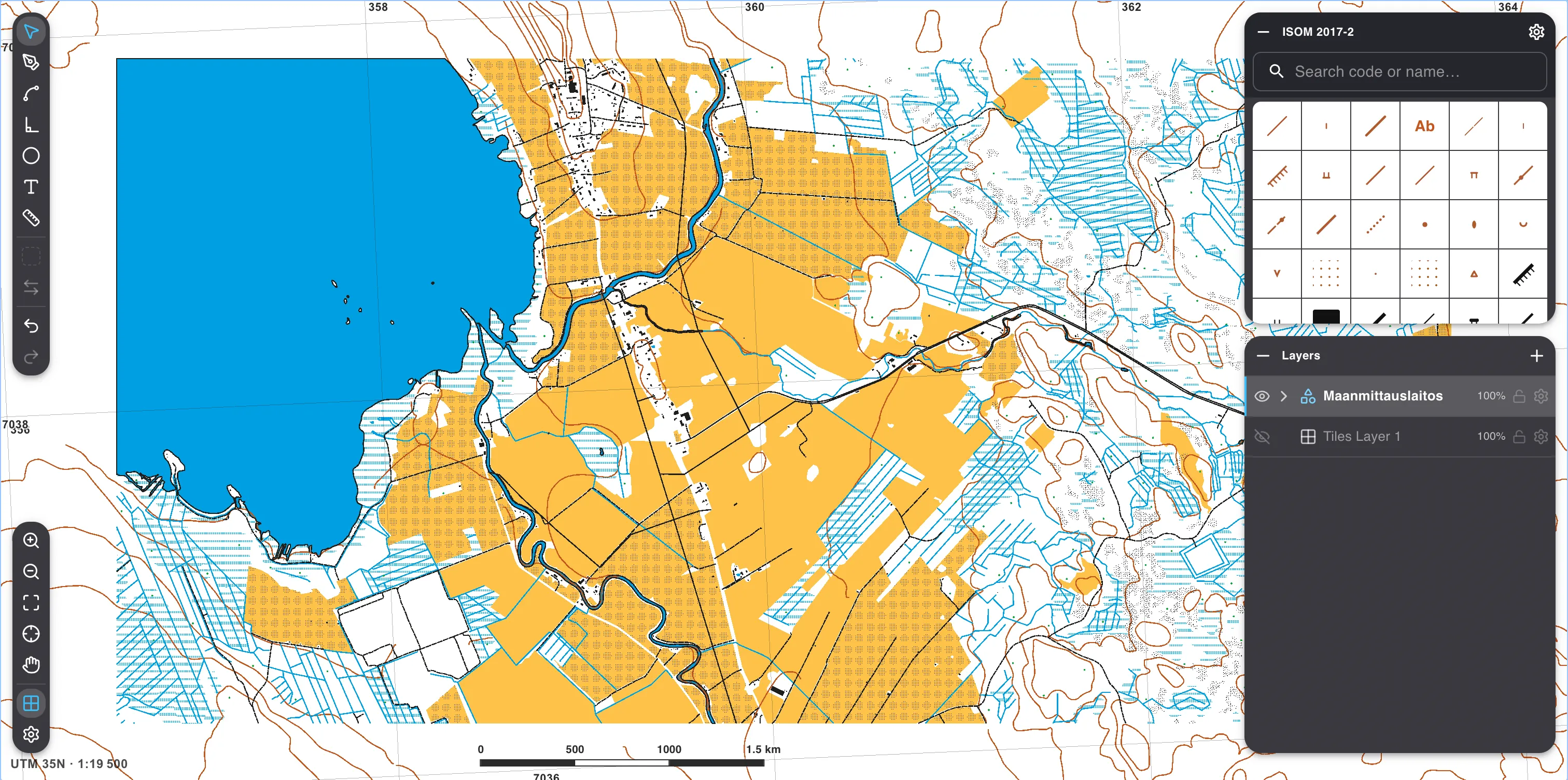
open the import tool for external sources;
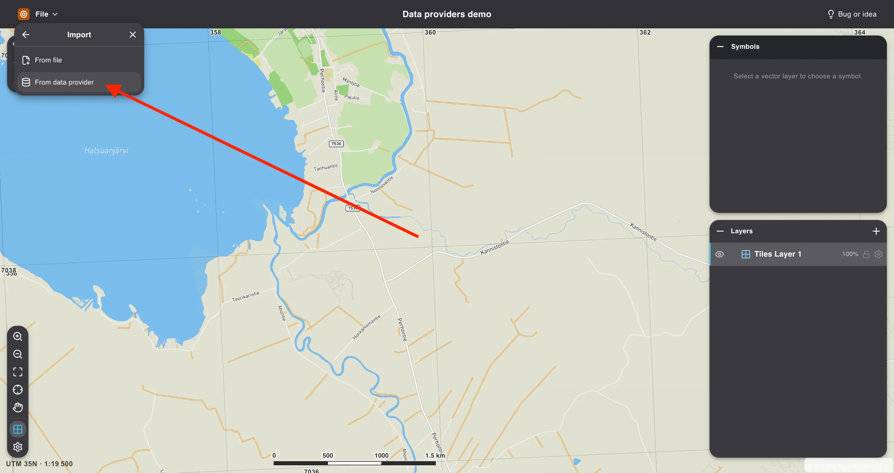
look at the list of providers — usually the national agency for that ground, OpenStreetMap, and Gratic Relief, our own store of heights that contours are drawn from;
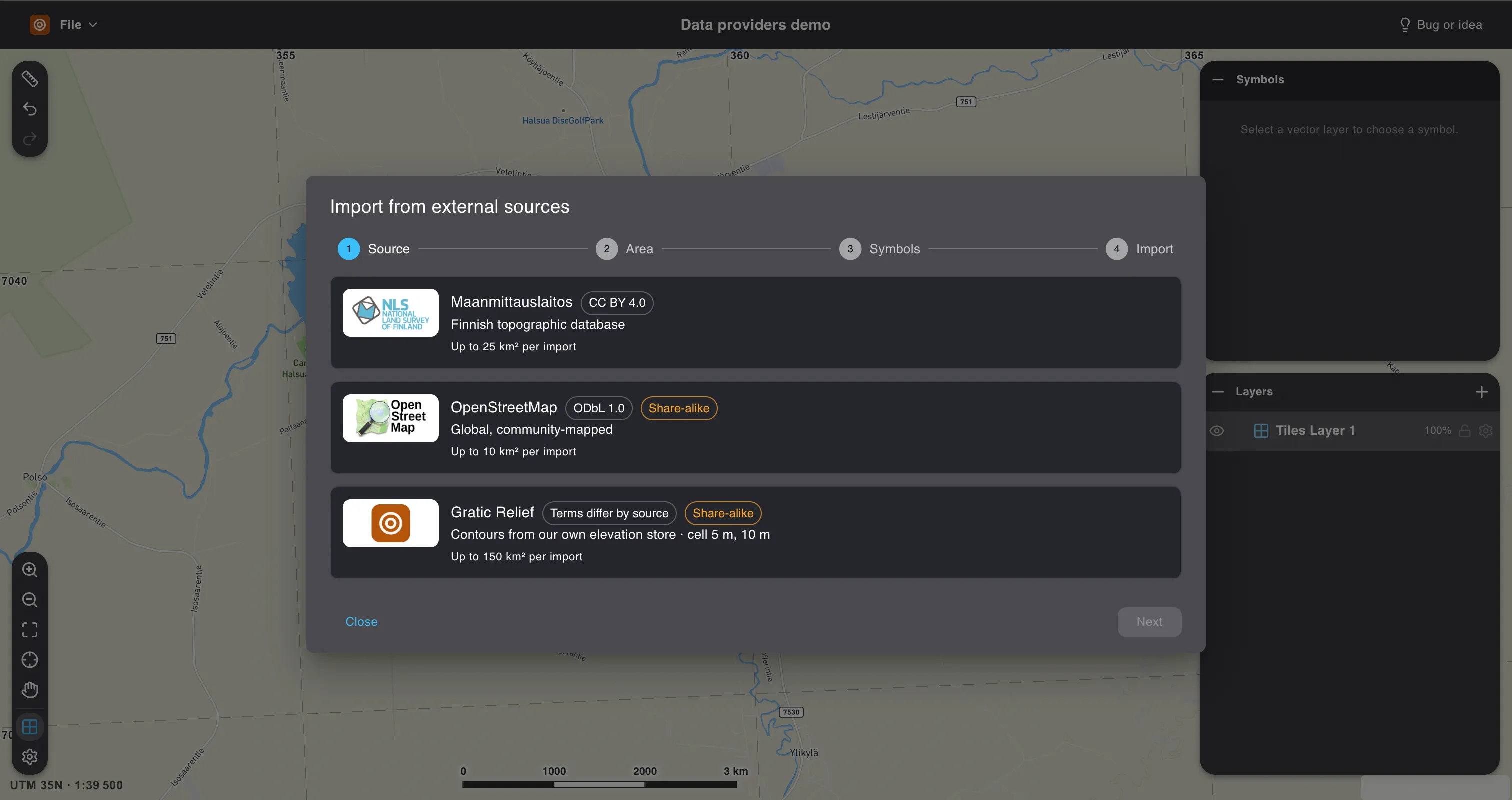
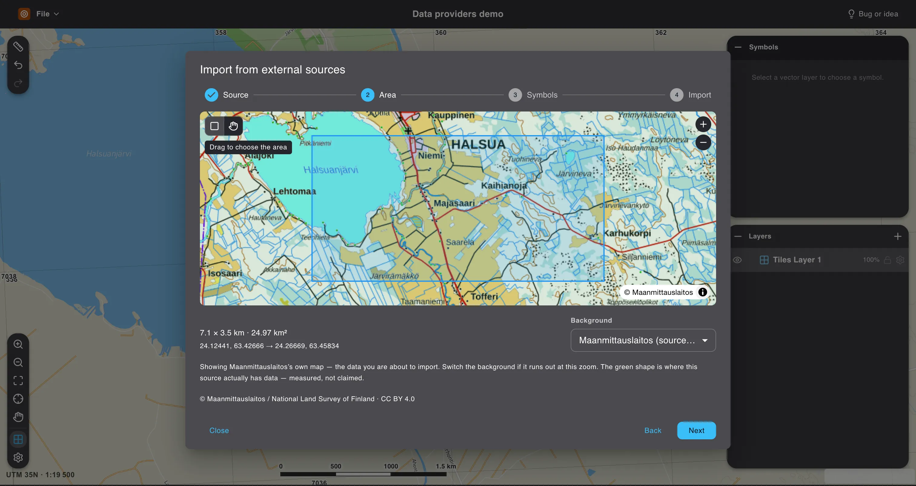
draw the area you want the data for;
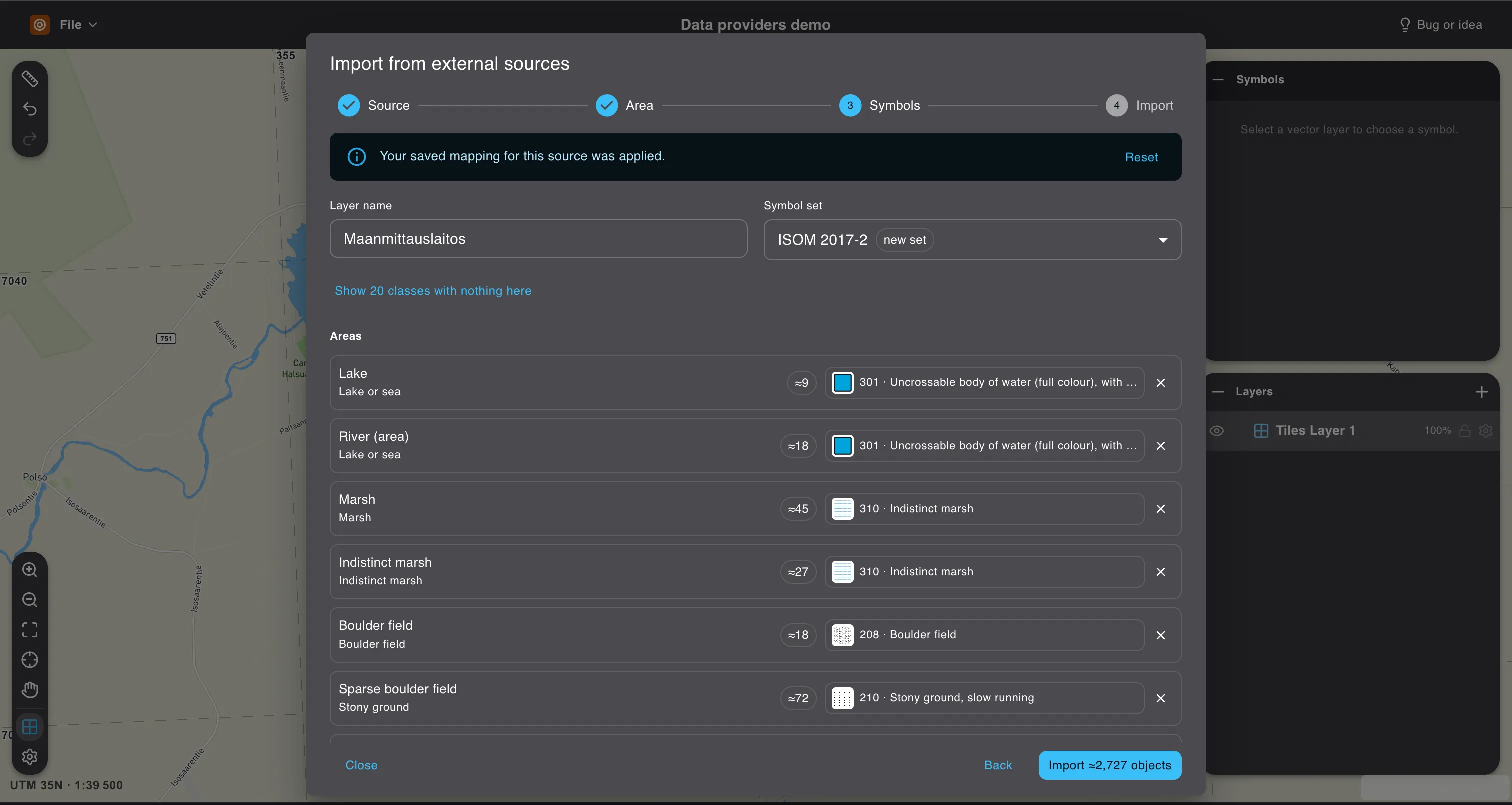
match the source’s classes to your own symbols — a cadastre does not keep ISSprOM 2019, so which symbol a road becomes is your call;
done: a finished base is sitting in its own layer.
One of our goals is to find every such source and connect it to Gratic.
The map above is where that stands today — switch it between LiDAR relief and connected vector services. The table at the foot of the page lists every territory we have connected, with the provider and the licence its data travels under.
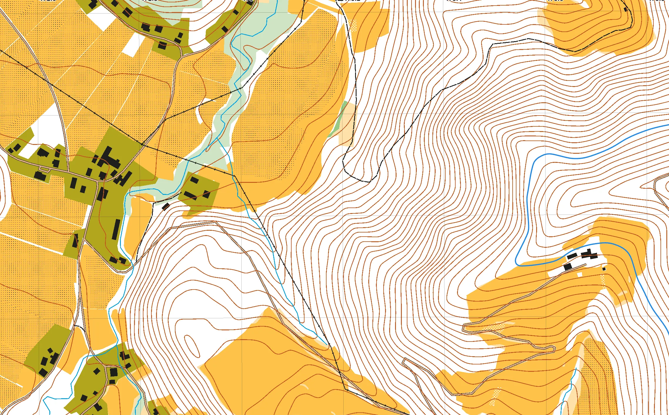
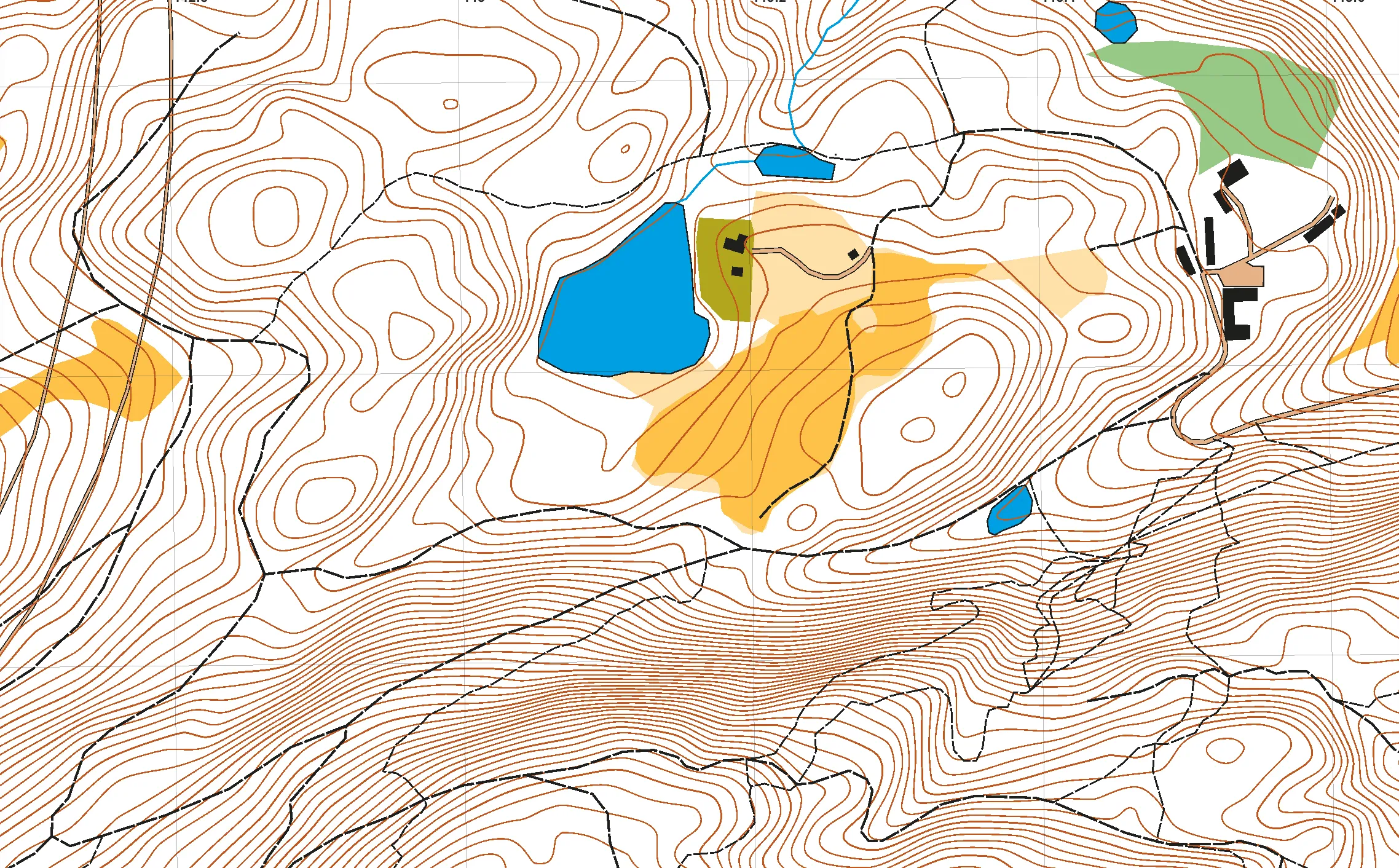
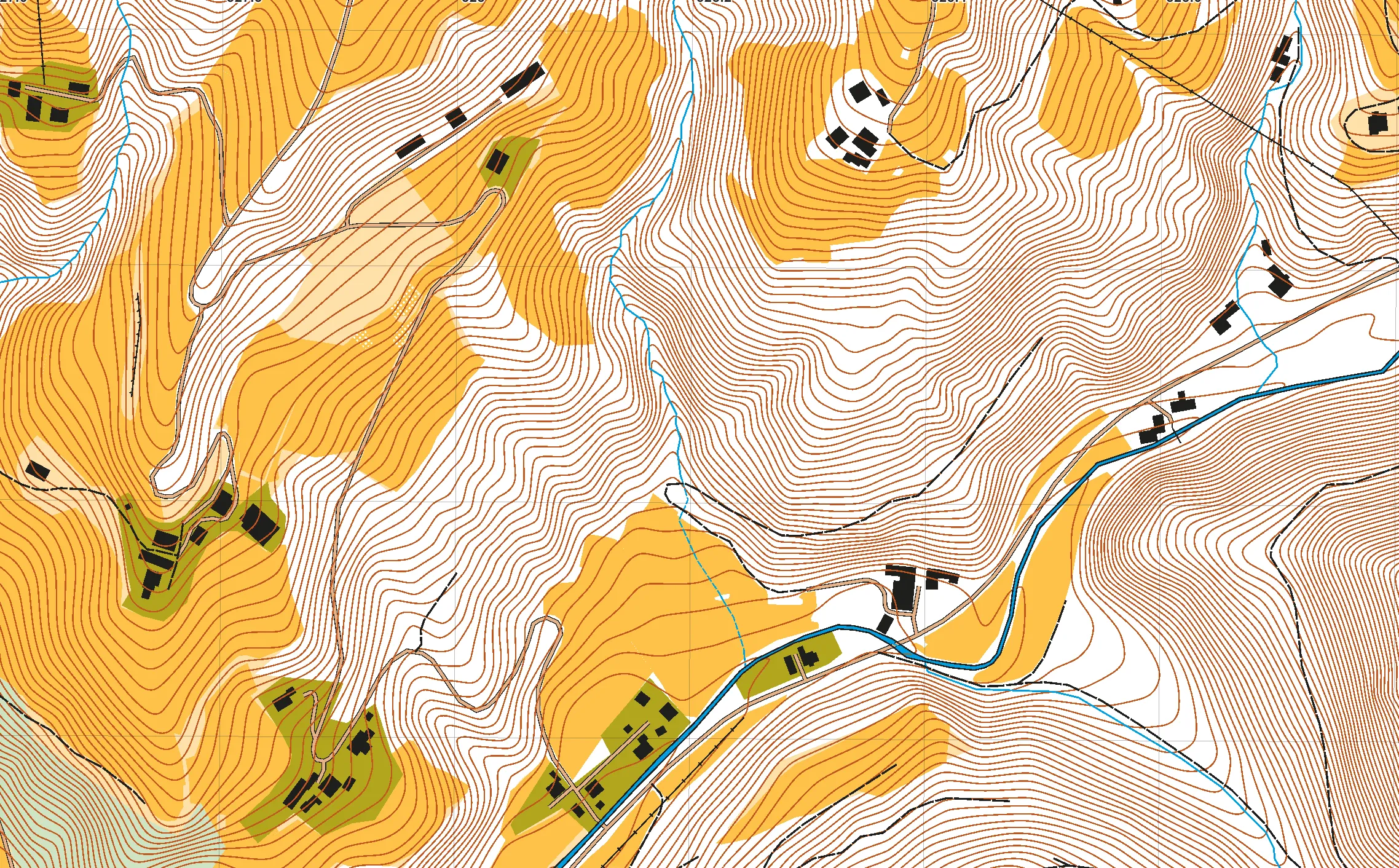
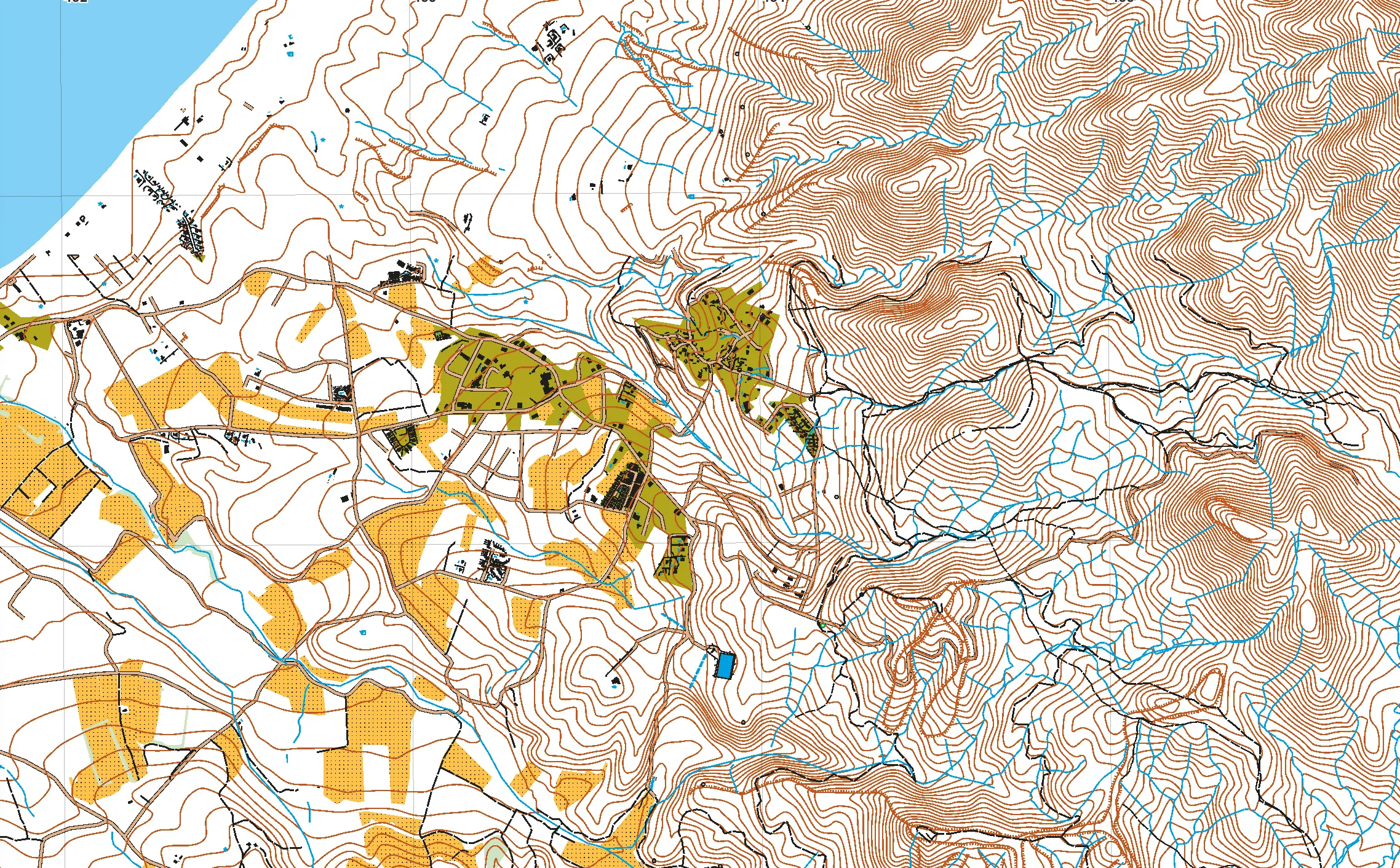
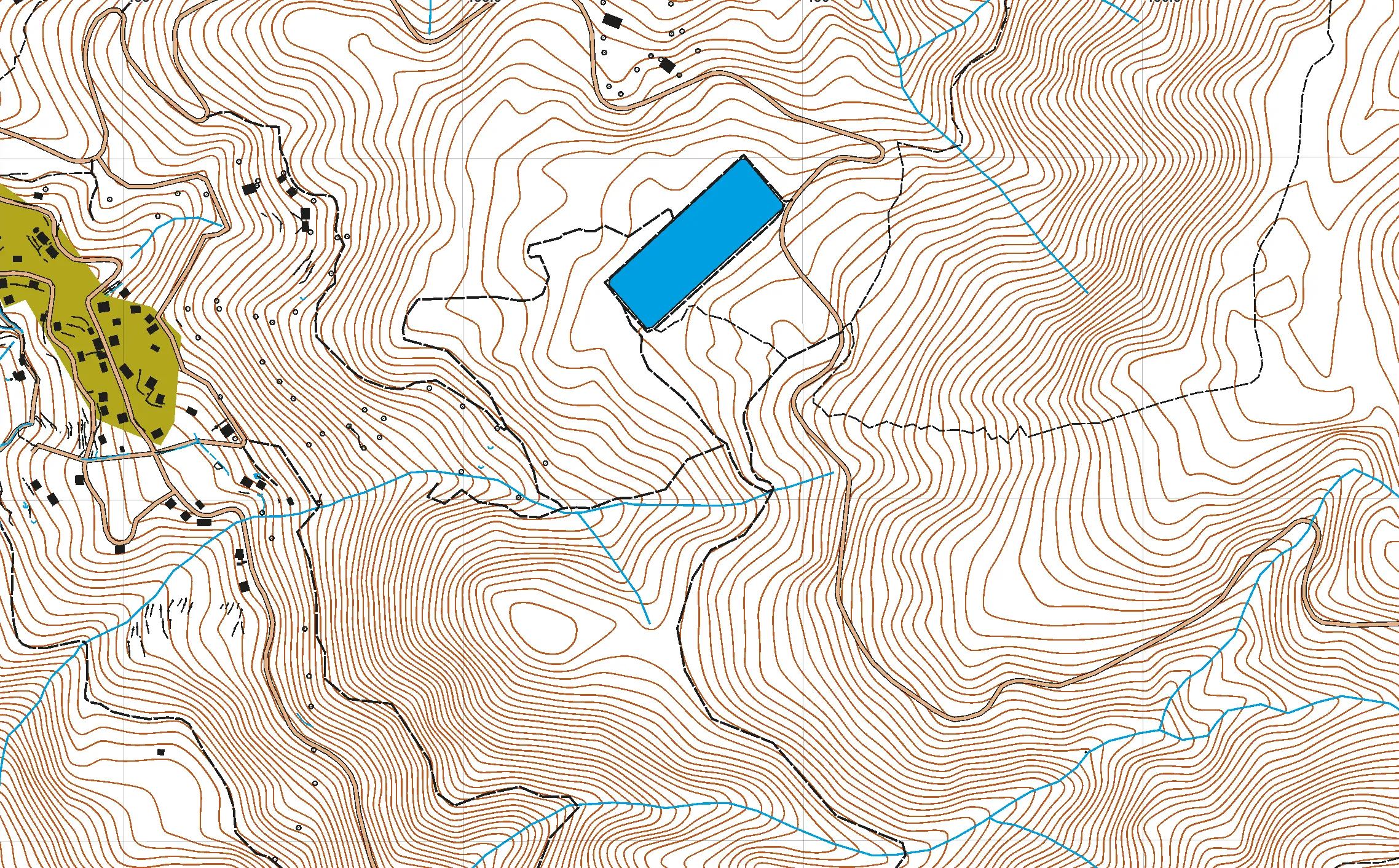
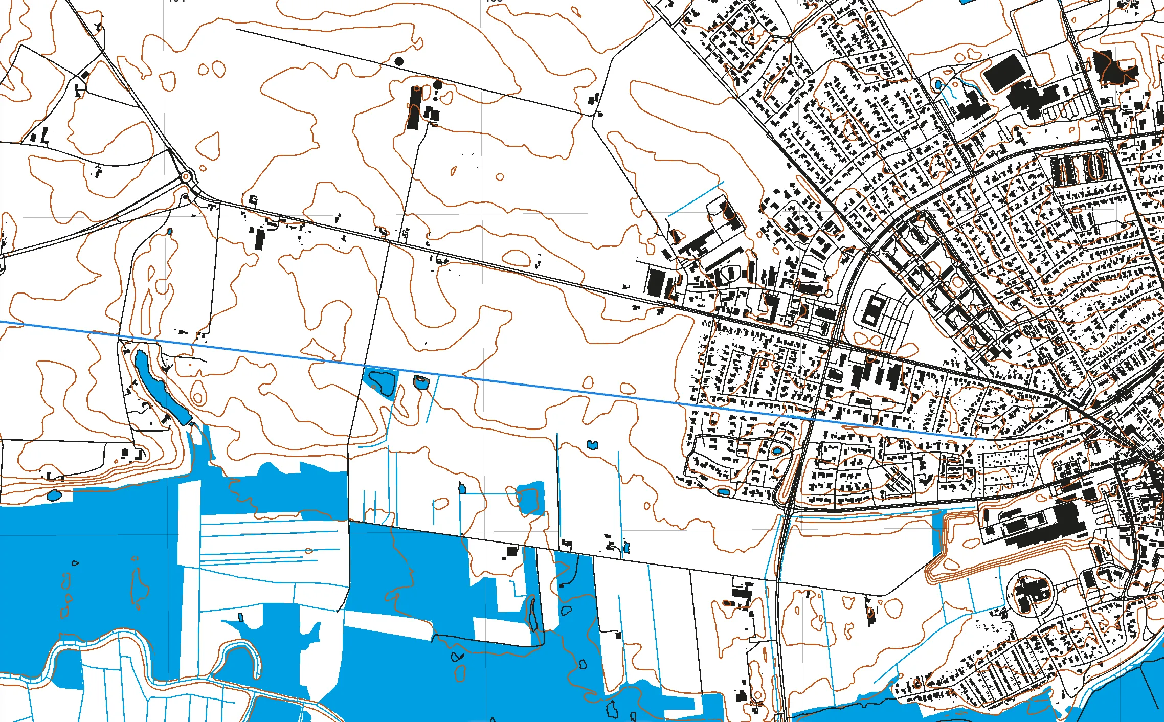
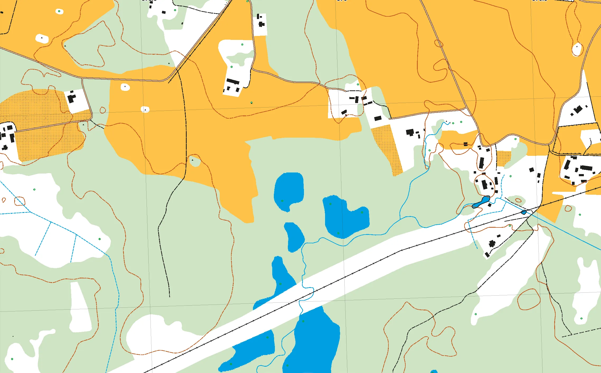
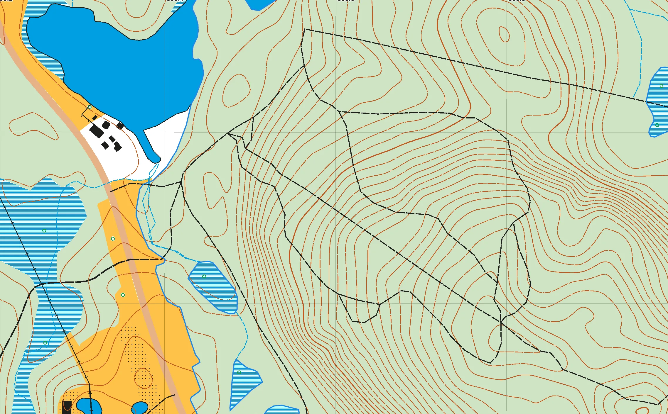
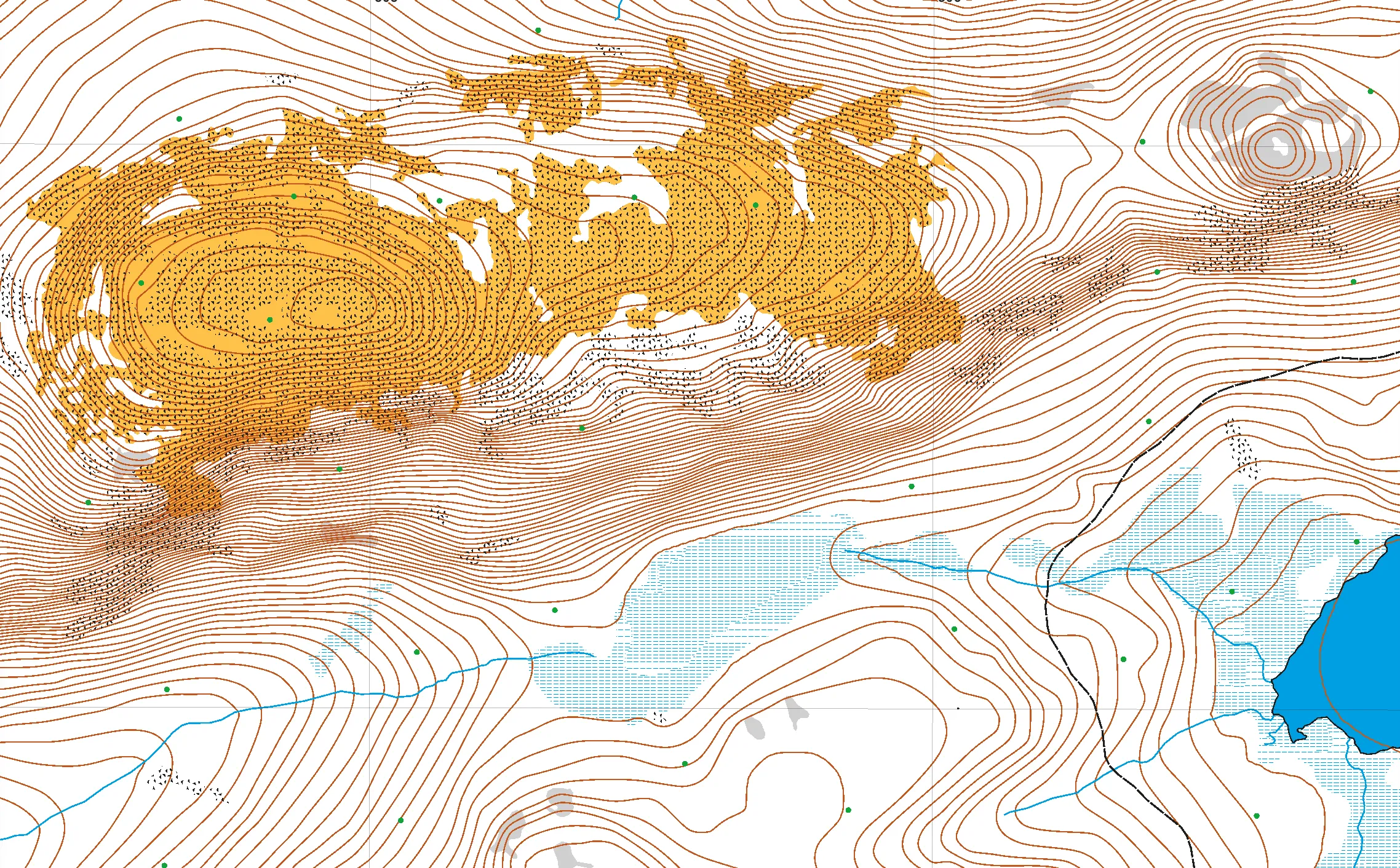
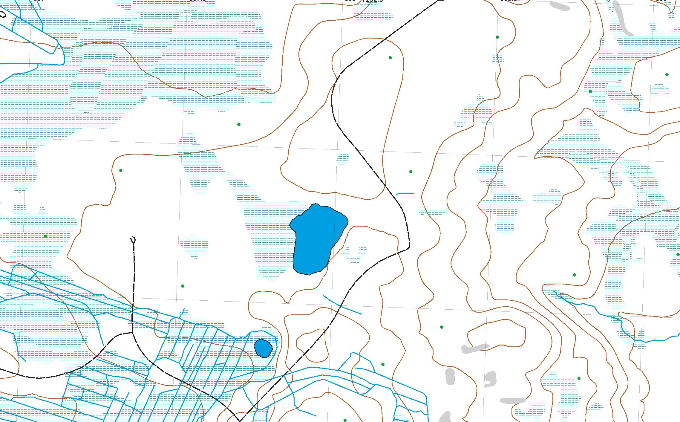
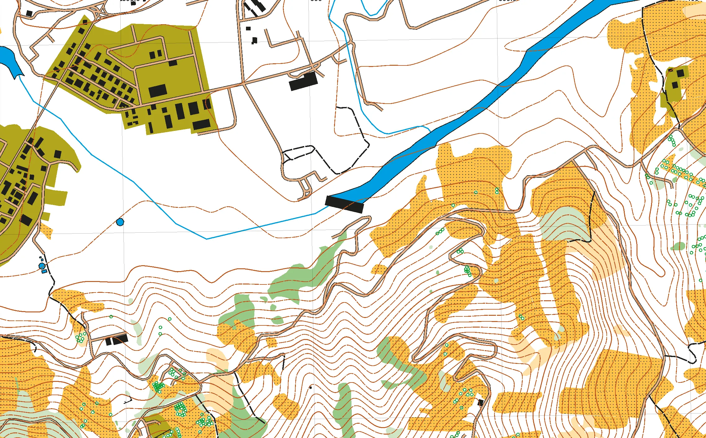
Examples of a base map
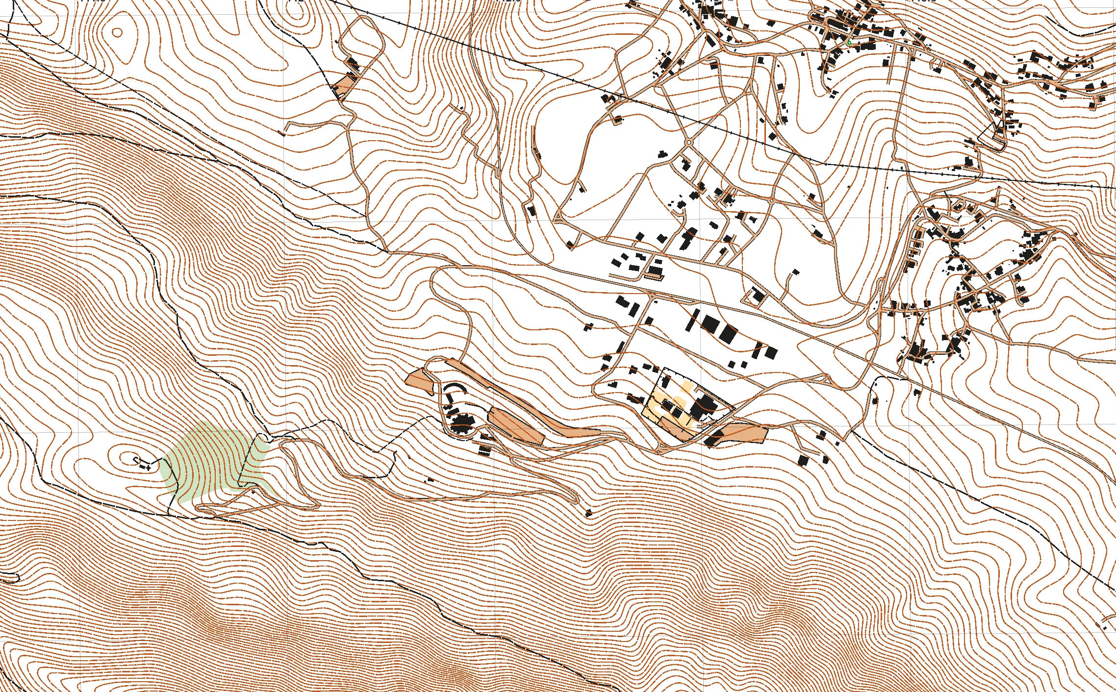
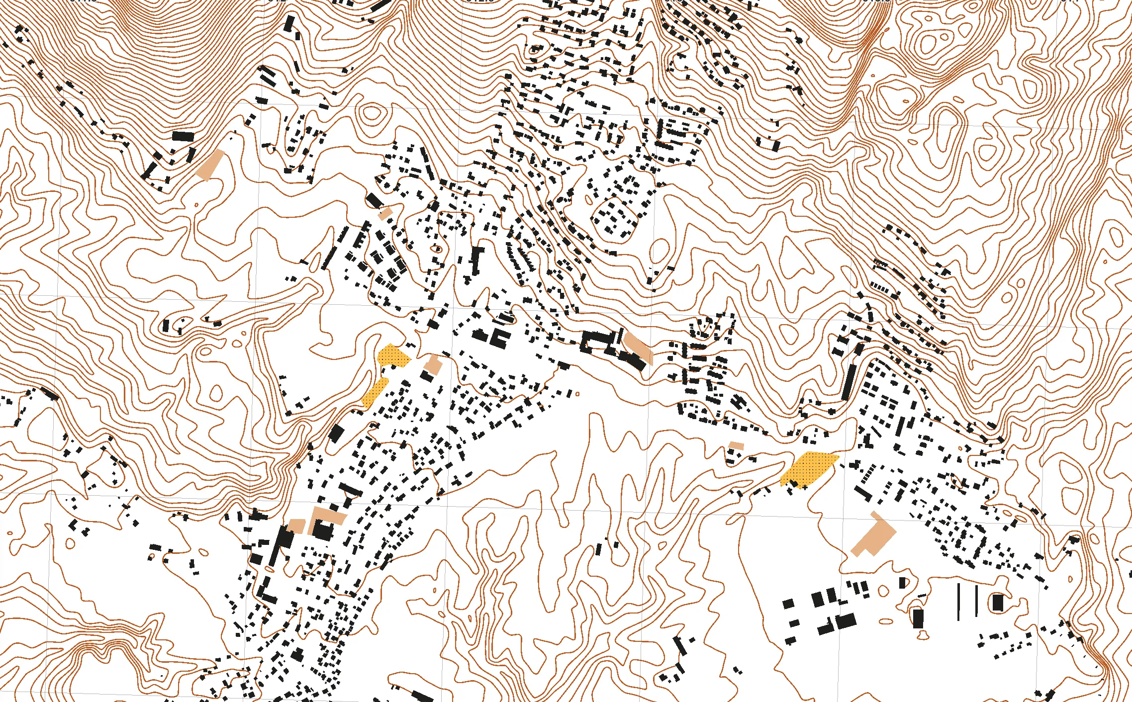
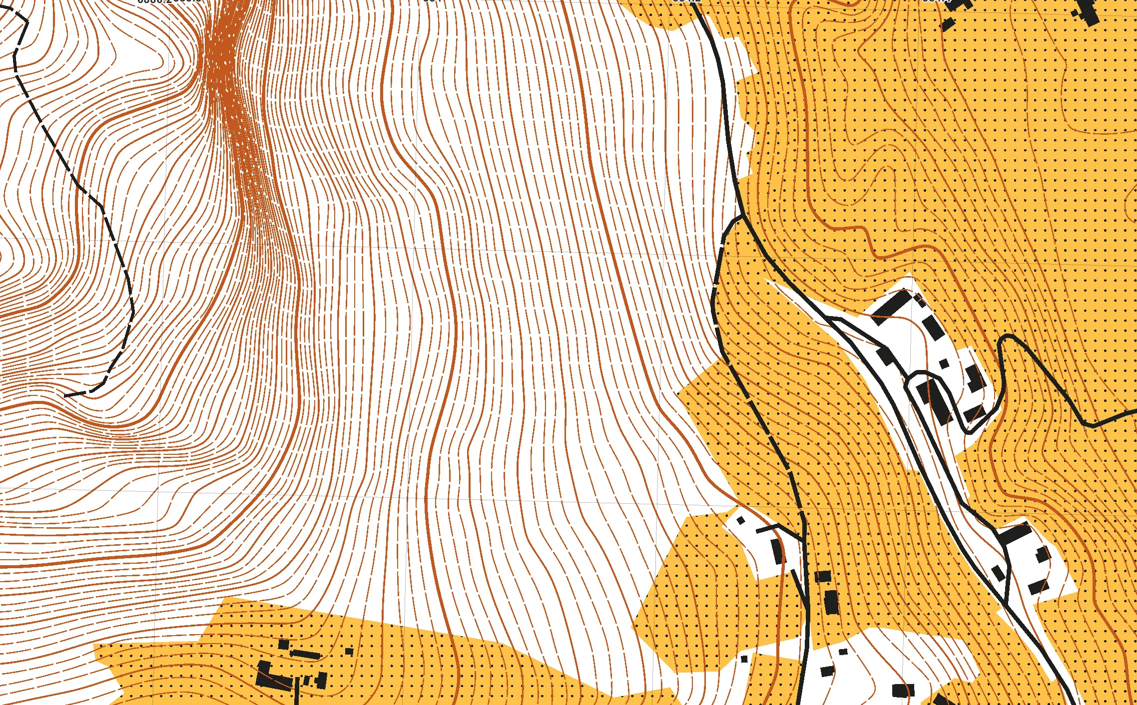
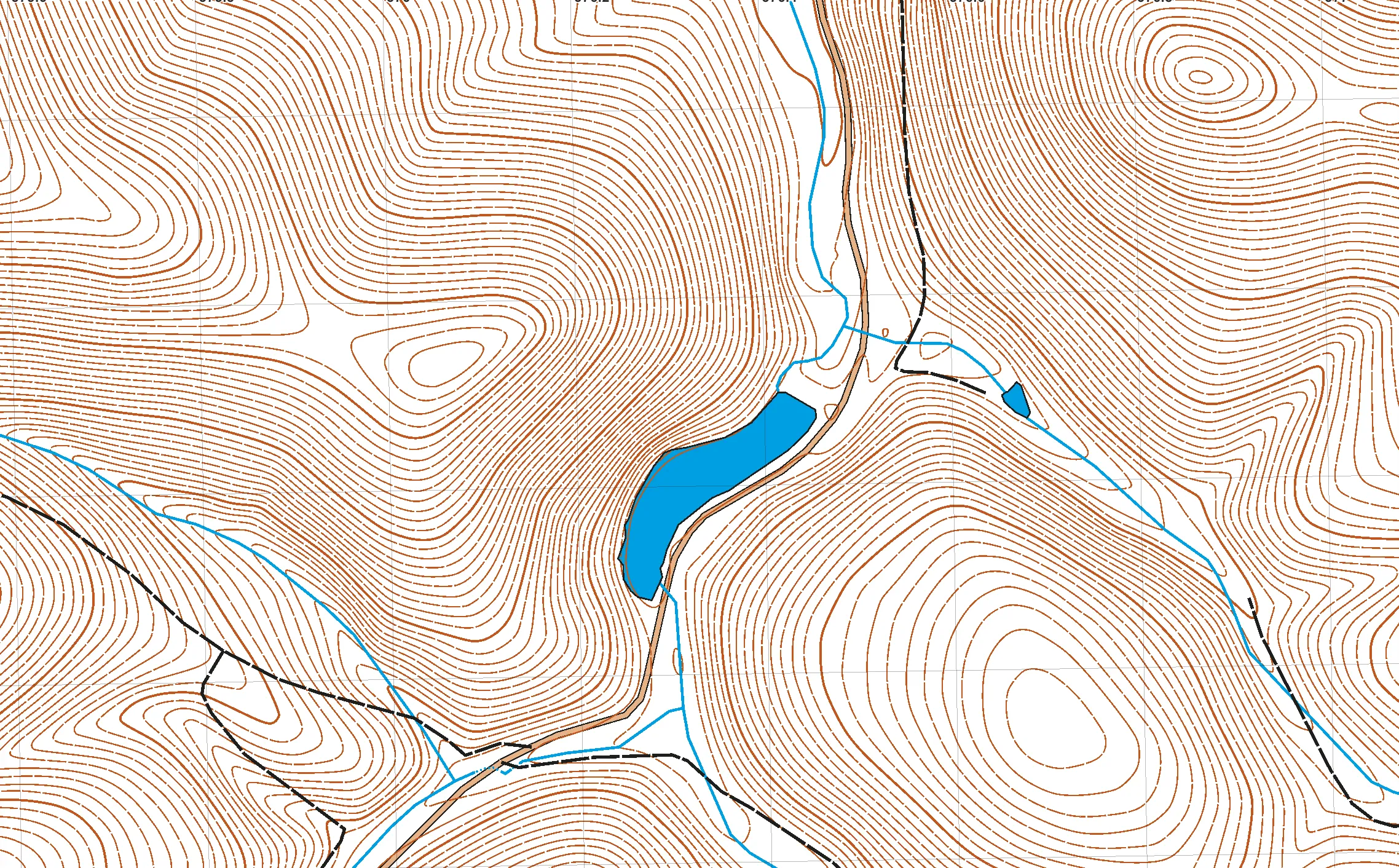
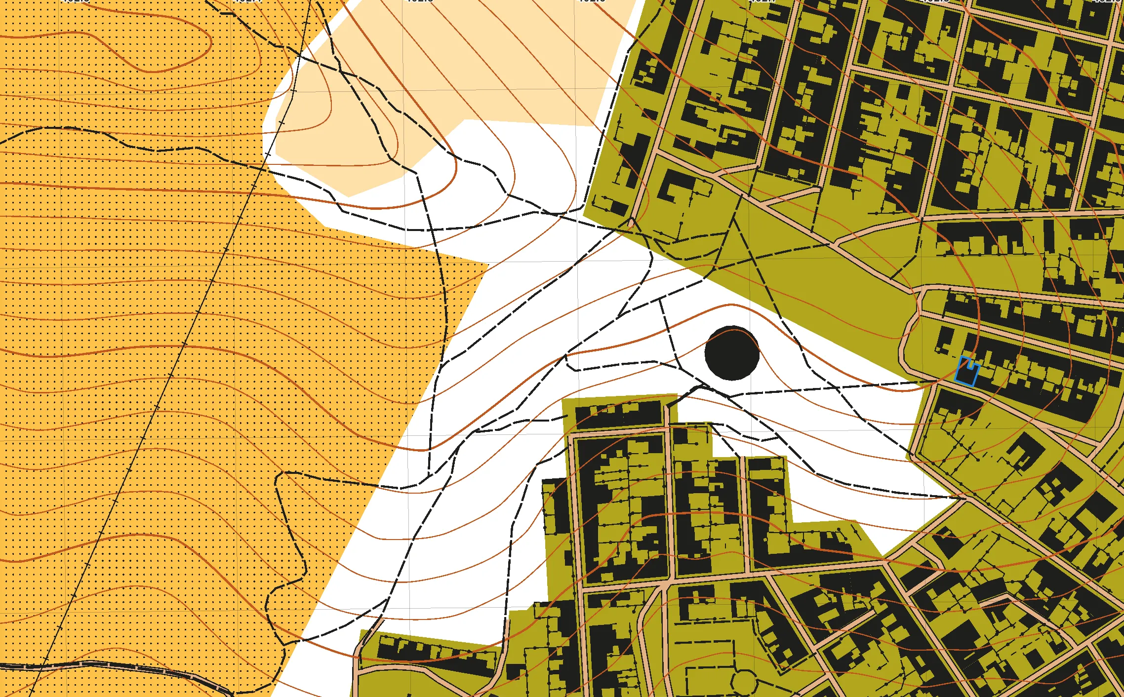
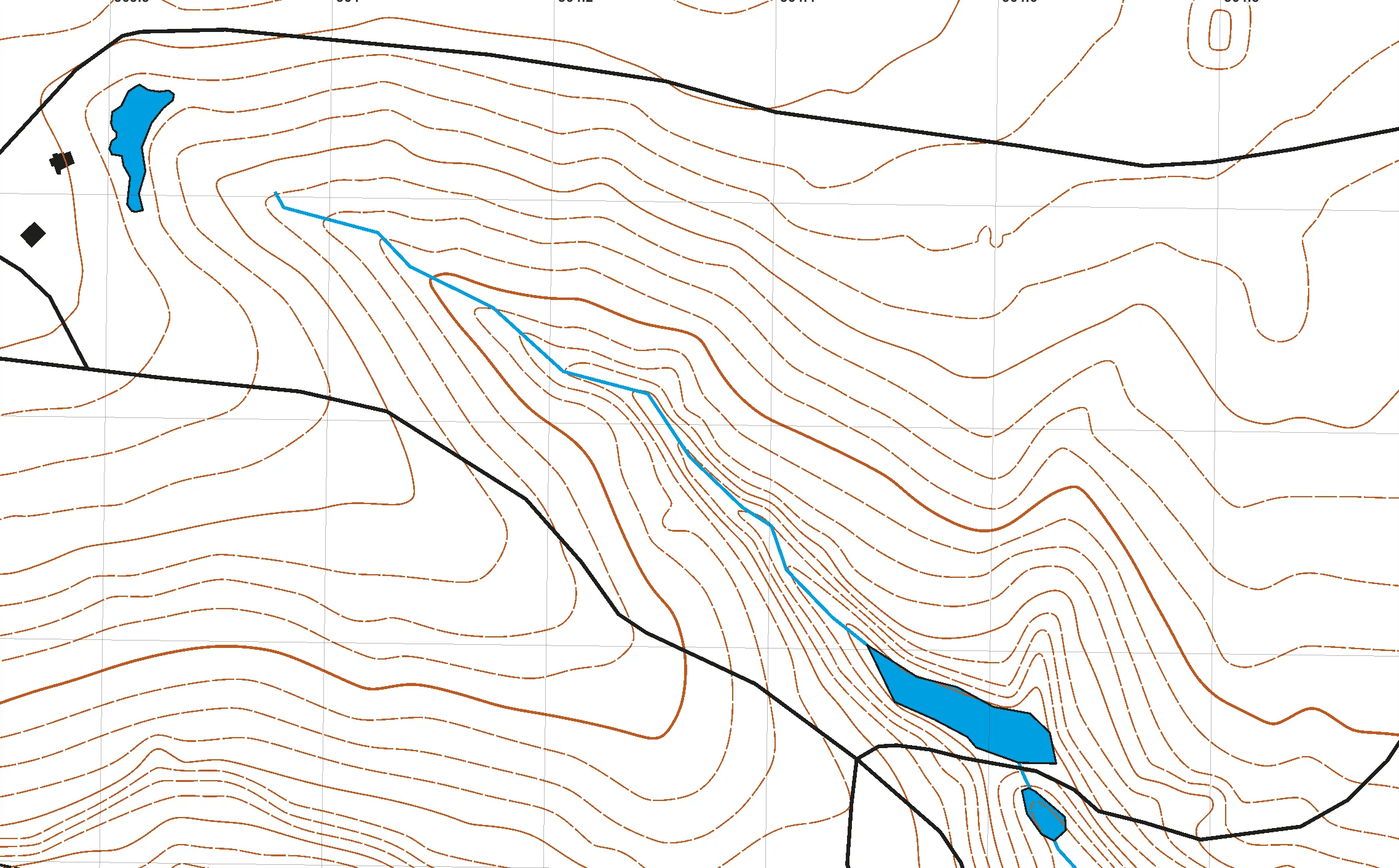
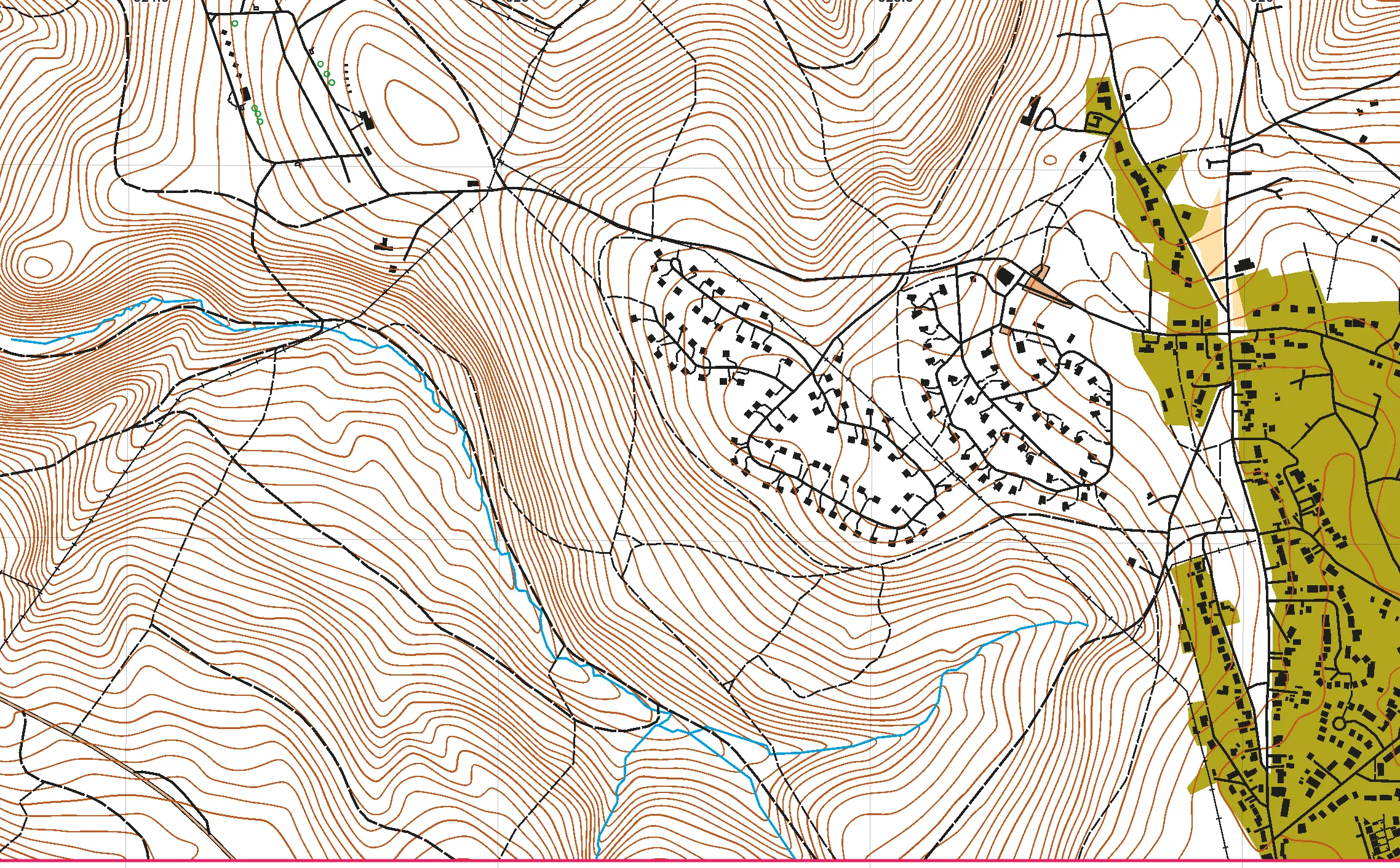
Every one of these was assembled by Gratic itself in about a minute — imported from open sources, with not a single object drawn by hand.
What is connected today
One row per territory we have signed for: the ground, the provider answering on it and the licence its data travels under. The list is read from the same territory files the editor obeys, so nothing here can promise what the editor will not deliver.
| Country | Territory | Provider | Licence | Elevation grid |
|---|---|---|---|---|
| Argentina | Buenos Aires |  GCBA GCBA | CC BY 2.5 AR | — |
| Austria | Austria |  AMA / LFRZ AMA / LFRZ | CC BY 4.0 | — |
| Austria | Austria | BEV | CC BY 4.0 | 5 m |
| Australia | New South Wales | NSW Spatial | CC BY 4.0 | — |
| Australia | Queensland | Queensland Spatial | CC BY 4.0 | — |
| Australia | Tasmania | the LIST | state terms published as a PDF | — |
| Australia | Victoria | Vicmap | CC BY 4.0 | — |
| Australia | Western Australia | Landgate SLIP | CC BY 4.0 | — |
| Belgium | Flanders | Digitaal Vlaanderen | Modellicentie voor gratis hergebruik v1.0 | 5 m |
| Belgium | Flanders |  Digitaal Vlaanderen Digitaal Vlaanderen | Modellicentie Gratis Hergebruik | — |
| Belgium | Wallonia | SPW | Creative Commons Attribution 4.0 International | 5 m |
| Belgium | Wallonia |  SPW Géoportail SPW Géoportail | CC BY 4.0 | — |
| Bulgaria | Bulgaria |  Министерство на земеделието и храните Министерство на земеделието и храните | «No conditions apply to access and use» + «no limitations to public access» | — |
| Brazil | Brazil |  IBGE IBGE | not read | — |
| Canada | Canada | NRCan / StatCan | OGL-Canada 2.0 | — |
| Switzerland | Switzerland | swisstopo | swisstopo open data (BGDI) | 5 m |
| Switzerland | Switzerland | swisstopo | swisstopo open data (BGDI) | — |
| Cyprus | Cyprus | Cyprus Department of Lands and Surveys | CC BY 4.0 | 5 m |
| Cyprus | Cyprus |  Department of Lands and Surveys Department of Lands and Surveys | CC BY 4.0 | — |
| Czechia | Czechia | ČÚZK | CC BY 4.0 | 5 m |
| Czechia | Czechia |  ČÚZK ČÚZK | ČÚZK open data | — |
| Germany | Bavaria | Bayerische Vermessungsverwaltung | CC BY 4.0 | 5 m |
| Germany | Brandenburg | Landesvermessung und Geobasisinformation Brandenburg | dl-de/by-2.0 | — |
| Germany | Bremen | Freie Hansestadt Bremen | CC BY 4.0 | — |
| Germany | Hesse | HVBG | Datenlizenz Deutschland – Namensnennung – Version 2.0 | 5 m |
| Germany | Lower Saxony | LGLN | CC BY 4.0 | 5 m |
| Germany | Lower Saxony |  LGLN LGLN | CC BY 4.0 | — |
| Germany | Mecklenburg-Vorpommern | LAiV | Datenlizenz Deutschland – Namensnennung – Version 2.0 | 5 m |
| Germany | North Rhine-Westphalia |  Geobasis NRW Geobasis NRW | Datenlizenz Deutschland | — |
| Germany | North Rhine-Westphalia | Geobasis NRW | Datenlizenz Deutschland – Zero – Version 2.0 | 5 m |
| Germany | Rhineland-Palatinate |  LVermGeo Rheinland-Pfalz LVermGeo Rheinland-Pfalz | Datenlizenz Deutschland | — |
| Germany | Rhineland-Palatinate | LVermGeo RP | Datenlizenz Deutschland – Namensnennung – Version 2.0 | 5 m |
| Denmark | Denmark |  Dataforsyningen / Klimadatastyrelsen Dataforsyningen / Klimadatastyrelsen | CC BY 4.0 | — |
| Denmark | Denmark | Klimadatastyrelsen | CC BY 4.0 | 5 m |
| Estonia | Estonia | Maa- ja Ruumiamet | Maa- ja Ruumiamet open data terms | 5 m |
| Estonia | Estonia |  Maa- ja Ruumiamet Maa- ja Ruumiamet | Estonian open data licence (attribution) | — |
| Spain | Spain |  CNIG / IDEE CNIG / IDEE | CC BY 4.0 | — |
| Spain | Spain | IGN / CNIG | CC BY 4.0 | 5 m |
| Finland | Finland | Maanmittauslaitos | CC BY 4.0 | 5 m |
| Finland | Finland |  Maanmittauslaitos Maanmittauslaitos | CC BY 4.0 | — |
| France | Corsica | IGN | Licence Ouverte / Open Licence 2.0 | 5 m |
| France | France | IGN | Licence Ouverte / Open Licence 2.0 | 5 m |
| France | France |  IGN IGN | Licence Ouverte / Etalab 2.0 | — |
| United Kingdom | England | Environment Agency | Open Government Licence v3.0 | 5 m |
| United Kingdom | Great Britain | Ordnance Survey | Условия OS Data Hub | — |
| Ireland | Ireland |  Tailte Éireann Tailte Éireann | CC BY 4.0 | — |
| Iceland | Iceland | Náttúrufræðistofnun | CC BY 4.0 | 10 m |
| Iceland | Iceland |  Náttúrufræðistofnun Náttúrufræðistofnun | open with attribution | — |
| Italy | Italy | INGV | CC BY 4.0 | 10 m |
| Italy | Lombardy |  Regione Lombardia Regione Lombardia | IODL 2.0 на топооснове CTR и CC BY 4.0 на землепокрове DUSAF | — |
| Italy | South Tyrol |  Autonomous Province of Bolzano Autonomous Province of Bolzano | CC BY | — |
| Italy | Veneto |  Regione del Veneto Regione del Veneto | IODL 2.0 | — |
| Luxembourg | Luxembourg | ACT | CC0 1.0 | 5 m |
| Luxembourg | Luxembourg |  ACT ACT | CC0 1.0 | — |
| Latvia | Latvia |  LĢIA LĢIA | CC BY 4.0 | — |
| Netherlands | Netherlands |  PDOK PDOK | CC BY 4.0 | — |
| Netherlands | Netherlands | Rijkswaterstaat / PDOK | CC0 1.0 | 5 m |
| Norway | Norway | Kartverket | CC BY 4.0 | 5 m |
| New Zealand | New Zealand | Toitū Te Whenua LINZ | CC BY 4.0 | 5 m |
| Poland | Poland | GUGiK | Regulamin Geoportalu, § 3 (art. 4 ust. 2 pr. aut.) — wolne wykorzystanie ze wskazaniem źródła | 5 m |
| Portugal | Portugal |  DGT DGT | CC BY | — |
| Sweden | Sweden |  Jordbruksverket Jordbruksverket | CC BY 4.0 | — |
| Sweden | Sweden | Lantmäteriet | CC BY 4.0 | 5 m |
| Slovenia | Slovenia |  GURS GURS | open (attribution) | — |
| Slovakia | Slovakia |  NLC Zvolen NLC Zvolen | CC BY 4.0 | — |
| Slovakia | Slovakia | ÚGKK / GKÚ | CC BY 4.0 | 5 m |
| United States | Alabama | USGS | U.S. Public Domain | 5 m |
| United States | Arkansas | USGS | U.S. Public Domain | 5 m |
| United States | Colorado | USGS | U.S. Public Domain | 5 m |
| United States | Connecticut | USGS | U.S. Public Domain | 5 m |
| United States | Delaware | USGS | U.S. Public Domain | 5 m |
| United States | Georgia | USGS | U.S. Public Domain | 5 m |
| United States | Iowa | USGS | U.S. Public Domain | 5 m |
| United States | Kansas | USGS | U.S. Public Domain | 5 m |
| United States | Kentucky | USGS | U.S. Public Domain | 5 m |
| United States | Louisiana | USGS | U.S. Public Domain | 5 m |
| United States | Maine | USGS | U.S. Public Domain | 5 m |
| United States | Maryland | USGS | U.S. Public Domain | 5 m |
| United States | Massachusetts | USGS | U.S. Public Domain | 5 m |
| United States | Missouri | USGS | U.S. Public Domain | 5 m |
| United States | Nebraska | USGS | U.S. Public Domain | 5 m |
| United States | New Hampshire | USGS | U.S. Public Domain | 5 m |
| United States | New Jersey | USGS | U.S. Public Domain | 5 m |
| United States | Oklahoma | USGS | U.S. Public Domain | 5 m |
| United States | Pennsylvania | USGS | U.S. Public Domain | 5 m |
| United States | Rhode Island | USGS | U.S. Public Domain | 5 m |
| United States | South Carolina | USGS | U.S. Public Domain | 5 m |
| United States | Tennessee | USGS | U.S. Public Domain | 5 m |
| United States | United States |  USGS The National Map USGS The National Map | public domain (US Government work) | — |
| United States | Vermont | USGS | U.S. Public Domain | 5 m |
| United States | Virginia | USGS | U.S. Public Domain | 5 m |
| United States | West Virginia | USGS | U.S. Public Domain | 5 m |
| United States | Wyoming | USGS | U.S. Public Domain | 5 m |
| Worldwide | World |  OpenStreetMap via Overpass OpenStreetMap via Overpass | ODbL-1.0 (SHARE-ALIKE) | — |
The grid step is the distance on the ground between two neighbouring height samples, and it sets the floor on what contours can show: a five-metre grid carries a 2.5 m contour interval confidently, a ten-metre one gives the shape of a hill and nothing smaller.
Questions people ask
Can I use these data in a map I sell?
Almost always yes, and the licence column says on what terms. Most services here publish under CC BY 4.0: you may use the data commercially and must credit the agency. OpenStreetMap is share-alike (ODbL), which reaches further — a map built on it carries the same obligation onward. Gratic keeps the licence on the imported layer and shows what you owe before you export.
What does the grid step mean, and what contour interval will I get?
The grid step is the distance on the ground between two neighbouring height samples. A five-metre grid carries a 2.5 m contour interval confidently; a ten-metre one gives the shape of a hill and nothing smaller. It is not the contour interval itself — you choose that when you generate the contours.
My country is not in the table. What now?
Tell us at hello@gratic.app where its agency publishes data. A working endpoint from somebody who already uses it saves us the better part of a day. What stops us is usually the same thing from country to country — an unfamiliar coordinate system, a format we do not read yet — so solving it once tends to open several countries at once.
How current is this list?
It is read from the same territory files the editor obeys, at build time, and the page says the date of the last change under the table. There is no second copy of this list anywhere.
If the country you map in is missing here and you know where its agency publishes data, tell us at hello@gratic.app: a working endpoint from somebody who already uses it saves the better part of a day.
How maps get drawn on top of this base is in our articles.
The exact coverage of the elevation store, tile by tile, is on the bucket map.